 Here
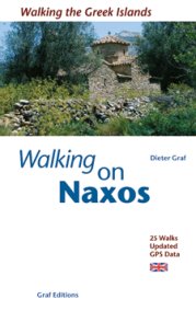
you can find the collected GPS-data and updated information to the walking guide
"Walking the Greek Islands - Naxos and the Small Cyclades" from
Christian Ucke and Dieter Graf, Munich 2003, graf-editions, ISBN 3-9803130-7-7.
I recommend to buy the book because there are detailed descriptions of the walking
routes and further helpful information. The GPS-data still don't exist for all
routes but will completed in future. Furthermore not all routes have altitude
information.
Hint: In the winter 2002/03 very strong rainfalls
generated big damages all over the island of Naxos. Also walking routes are
affected. Parts of some routes are difficult or not accessible at all.
The text-files (in the folder text-data)
can be printed out and entered manually into a GPS-device. This is a hard job
and furthermore easily leads to mistakes. There are many programs which allow
to upload GPS-data directly into a GPS-device. Among others I have used GPS-Utility
(http://www.gpsu.co.uk/) for my GARMIN
etrex summit. Some of them are freeware, some shareware, some more or less expensive.
Many of these allow to import data in the GPX-format (extension gpx) or PCX5-format
(extension .rte). These data are stored in the folder GPX-Data
or PCX5-Data.
Detailed information about GPS hard- and software is available on http://gpsinformation.net/.
Once more it is pointed out that GPS-data have only an accuracy of about 30m.
The accuracy of GPS-data depends among others from the position, number and
signal strength of the satellites. Principally you should never trust on a GPS-device
alone. On my walking I used the Garmin etrex summit and GPS72 with map datum
WGS84.
There is no warranty for the correctness of the data!
Please let me know if you have suggestions to improve the availability or the
handling of the GPS-data.
C. Ucke/April 2003
 Here
you can find the collected GPS-data and updated information to the walking guide